Ten Trails
Bellingham
January 2019
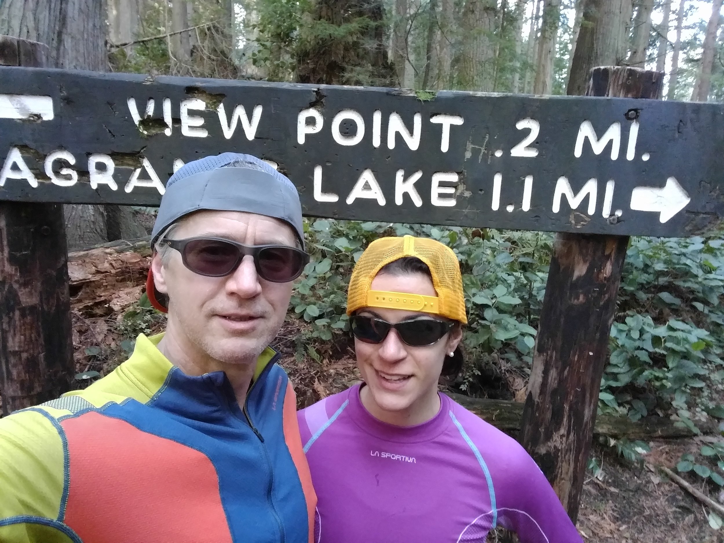
Fragrance Lake up
Start: Gate at bottom of Fragrance Lake trail
Finish: Gate at top of Fragrance Lake trail
Description: From the start climb on the main trail. At about 0.8 miles is the photo spot. For the Strava challenge keep to the right at the intersection (left just takes you to an overlook).
Instagram photo spot: The sign at 0.8 miles - #ttcb1
Strava trail segment: Fragrance Trail Uphill Gate to Gate - 1.32 miles
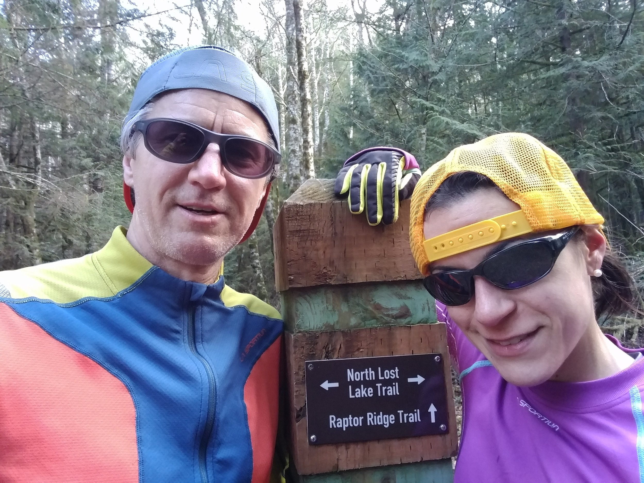
lost lake loop
Start/Finish: Bottom of Dan’s Traverse on Cleator road.
Description: Start up Dan’s Traverse. At the top take a left on the Chuckanut Ridge trail. Follow the Chuckanut Ridge trail down to North Lost Lake trail. Follow North Lost Lake trail to the intersection at Lost Lake, take a right to head towards South Lost Lake trail. At the top of the long climb, take a right to continue down South Lost Lake trail. Just past the gate take a right onto Fragrance Lake road and continue up to Cleator. Left and follow Cleator back to the start.
Instagram photo spot: The intersection of North Lost Lake trail and Raptor Ridge trail - #ttcb2
Strava trail segment: Lost Lake Cleator Loop - 7.98 miles

Two Dollar Down
Start: Fragrance Lake Loop + Two Dollar Intersection
Finish: Cleator Rd
Description: At the intersection of the Fragrance Lake Loop and Two Dollar, head up and take the first right, wind down staying right (essentially just stay on the main trail, there are only old leaf covered, un-maintained trails that intersect), there are some small rolling hills but mostly you will descend (about halfway there is a waterfall on your right which is the photo spot), at the end of the steep downhill switchbacks, end at Cleator Rd.
Instagram photo spot: Waterfall half way down Two Dollar - #ttcb3
Strava trail segment: $2 Down - 1.64 miles

Raptor Ridge
Start: North Chuckanut Trailhead
Finish: Raptor Ride Trail + Raptor Ridge Viewpoint Intersection
Description: From North Chucknut Trailhead, head up to Urb, left on Urb, take the second left (first goes to California St) and head up, left onto Chuckanut Falls, stay right, left at Hemlock intersection, left onto Huckleberry, straight across Hemlock onto Unnamed singletrack, left at Raptor Ridge Trail, finish is another tenth of a mile or so at the intersection with Raptor Ridge Viewpoint (this is the photo spot).
Instagram photo spot: Raptor Ride Trail + Raptor Ridge Viewpoint Intersection - #ttcb4
Strava trail segment: North Chuckanut to Raptor Ridge Most Singletrack - 3.66 miles

Galbraith November to Kilo
Start: Parking lot at end of Birch St., November checkpoint
Finish: Kilo checkpoint
Description: Start at the parking lot and take the first left to begin climbing the switchbacks. As you emerge from the trees stay to your right on the edge of the hillside. Soon there is a split, stay left (though right is only a slight deviation). At the overlook continue down the dirt road. Take the second right. At the split stay right. You will soon finish at the Kilo checkpoint.
Instagram photo spot: The Family Fun Center bike at the Kilo checkpoint - #ttcb5
Strava trail segment: Ridge Trail - 1.37 miles
Stimpson Main Loop
Start/Finish: Parking Lot Access Trail + Main Loop Trail Intersection
Description: From the parking lot, follow the trail to the Main Loop intersection, this is the start. Head left (clockwise), stay right at all intersections until you complete the loop and arrive back where you started.
Instagram photo spot: Stone Bench just past 1.5 miles, the high point of the loop, from the start of the loop clockwise. - #ttcb6
Strava trail segment: Stimpson Full Main Loop - 2.29 miles
Whatcom woburn to Hatchery PArking Lot
Start: New parking lot on Woburn, starting at the intersection of the trail and sidewalk
Finish: Parking lot at Hatcery
Description: Start on the sidewalk where the new trail intersects, climb to the next intersection with Arbot Ct (this intersection is the photo spot), turn left and it’s a straight shot up until the trail curves left towards the Hatchery parking lot.
Instagram photo spot: New Woburn Trail & Arbor Ct Intersection - #ttcb7
Strava trail segment: Woburn Parking Lot to Hatchery Parking Lot - 1.06 miles

Padden horse trails loop
Start: From the dog park parking lot at the sign, take a left on the trail. Start/finish is at the first intersection.
Description: Run along the lake loop clockwise (i.e. with the lake on your right), on the steep downhill before the bridge, take a left onto the single track trail, at the top of the hill continue on the double track, at the end of the straightaway take a right onto the single track, follow the single track always staying right, you will eventually cross the power line, continue staying right, you will eventually end up at Padden park high point and will then begin the descend. At the next intersection, take a left (this is the photo spot). Next intersection a right, you will soon cross the power line again, descend some more and complete the loop.
Instagram photo spot: The intersection of the Padden horse trail and the Samish parking lot connector - #ttcb8
Strava trail segment: Horse Trails Loop - 5.52 miles
Lookout mountain Rufus Creek Down
Start/Finish: Rufus Creek + Cougar Ridge Intersection
Finish: Lookout Mountain Preserve Parking Lot
Description: From the start stay left at intersections, eventually you will wind your way down to where Cougar Ridge comes from the left and reconnects with Rufus Creek (this is the photo spot), stay right, coming down a hill you will approach an intersection, take the trail to the right (Rufus Creek) with the dark pea gravel, continue on the main trail, you will cross the dirt/gravel road and continue on Rufus Creek trail, continue staying right. Finish at the parking lot.
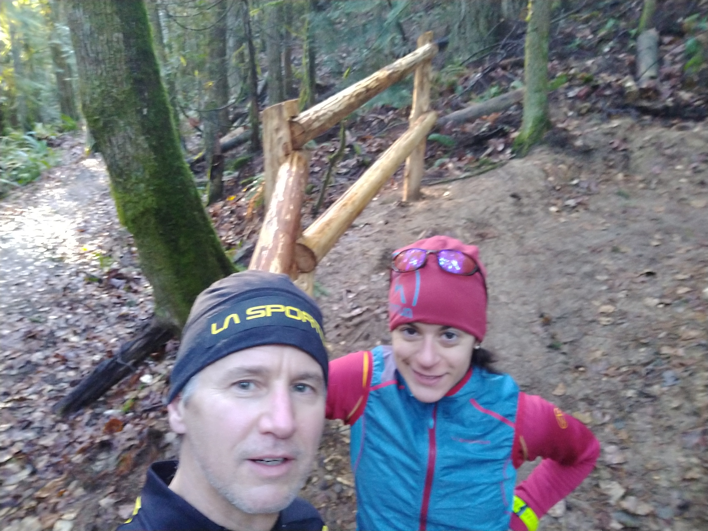
Instagram photo spot: Starting at the parking lot, the opposite of the Strava segment described above, the photo spot is the new fence at the intersection with the Cougar Ridge trail - #ttcb9
Strava trail segment: Rufus Creek Down - 4.1 miles

North Shore
Start: Far end of the North Shore/Hertz trail
Finish: Large wood entrance structure where the parking lot access trail meets the main trail along Lake Whatcom.
Description: Start at the far end of the North Shore/Hertz trail (this is the photo spot) and run the main trail to the wood entrance structure. For purposes of Strava continue past the structure to make sure the segment registers.
Instagram photo spot: Far end of the North Shore/Hertz trail - #ttcb10
Strava trail segment: North shore trail : back - 2.94 miles

Sponsor of the Ten Trail Challenge